|
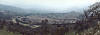
Flying into
Tehachapi! |
 |
Tehachapi is rich in Railroad
history
|
Best time of the year to go? |
All year |
|
Flight time in a Super Viking from KAJO? |
0.8 |
|
Food on the airport? |
Within walking distance,
very good. |
|
Fuel on airport? |
Yes, usually a good price |
|
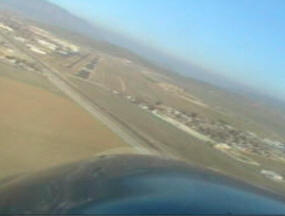
Comments about arriving and departing |
Departing at night watch for
hill off end of RWY 29. |
Rate this trip
10 being best, 5 being average. |
7.0 |
|
|
Tehachapi has a lot of
Rail Road History. |
|
At an elevation of 3998 feet,
Tehachapi's Municipal Airport is known as the corridor to Northern
and Southern California! Located at the southern end of the Sierra
Nevada Mountains, Tehachapi is an ideal spot to stop not only to
fuel, but to enjoy an old fashion mountain town with good food and
great prices.
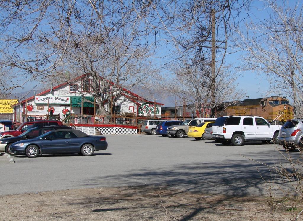
The Apple Shed Restaurant is an easy walk from
the flight line. Originally the shed
was used to pack and ship potatoes and potato seed. Thousands of
tons of potatoes were shipped to the U.S. Navy during World War II.
Later, certified Merion bluegrass seed was packed and shipped to
growers all over the world.
Not Disneyland but Tehachapi has a few things
to see and the maps placed around town make everything easy to find.
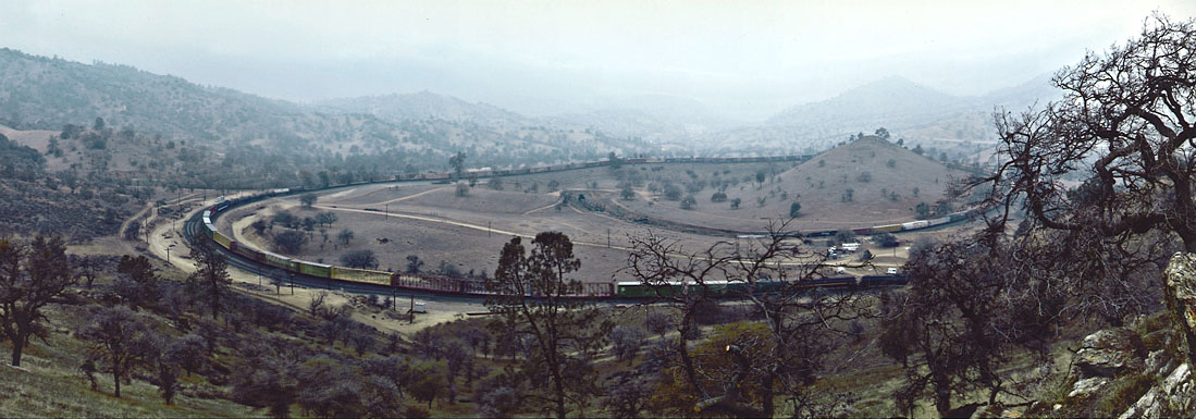
The city has a rich railroad history with the Tehachapi Loop near by. The
Tehachapi Loop is one of the few places in the world where a train
passes over itself which is necessary to climb the grade.
|
|
Pictures
from Tehachapi ! |
|
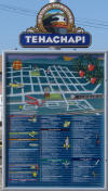 |
After landing walk to the
fuel island where you will find this sign (these signs are
all over town). Just west of the fuel island is the gate
which leads to town. As you head out the gate walk south on
the dirt path. Cross the RR tracks and turn right and you're
on the main drag! You can follow the paved road but the walk
is about 4 times as long. |
 |
The first business you'll
see is the Apple Shed which is only about one half mile from
the airport. As you can see in the picture this used to be a
loading dock for trains. |
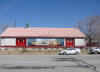 |
The Apple Shed from the
street.
http://www.appleshedonline.com/
|
 |
No town would be complete
without...... |
 |
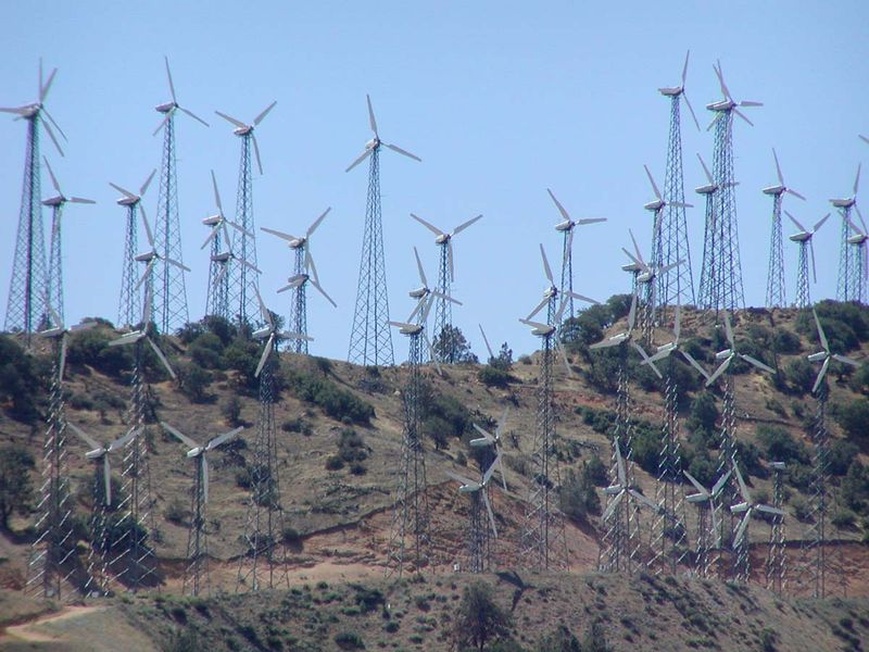
The area around its east and
south is also home to one of California's larger
Wind farms, generating
electricity. The turbines have been in place since the early
1980s and have been
upgraded through the years. The original wind turbines were
much smaller than the much taller and larger new version
turbines now sited for use. They are easily seen from
California State Route 58
and from Tehachapi-Willow Springs Road. |
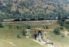 |
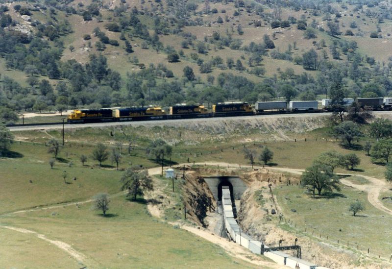
The biggest
engineering challenge was an area just east of the current
town of Keene. Here, the need for an increase of almost 80
feet elevation demanded a unusual solution. Engineer William
Hood, in a 19th century example of out-of-the-box thinking,
designed what has become one of the Seven Wonders of the
Railroad World: the Tehachapi Loop. |
 |
This single track line,
essentially unchanged, is still in constant use today, 122
years after its completion. It passes an average of 36
freight trains each day. This attests to the superior job of
both engineering and construction done by the two civil
engineers and the Chinese laborers. |
 |
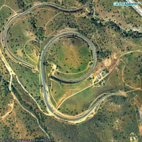
The trackage
from Caliente to the Tehachapi Pass was completed in July of
1876. As you can see in the aerial photo above, the tracks
loop around a hill and cross over themselves, gaining (or
losing) 77 feet of elevation in the process. Trains more
than 4,000 feet long circle over themselves, a rare
phenomenon that brings rail fans from all over the world to
the Loop. |
|
|
|