|
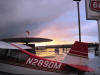
Corona
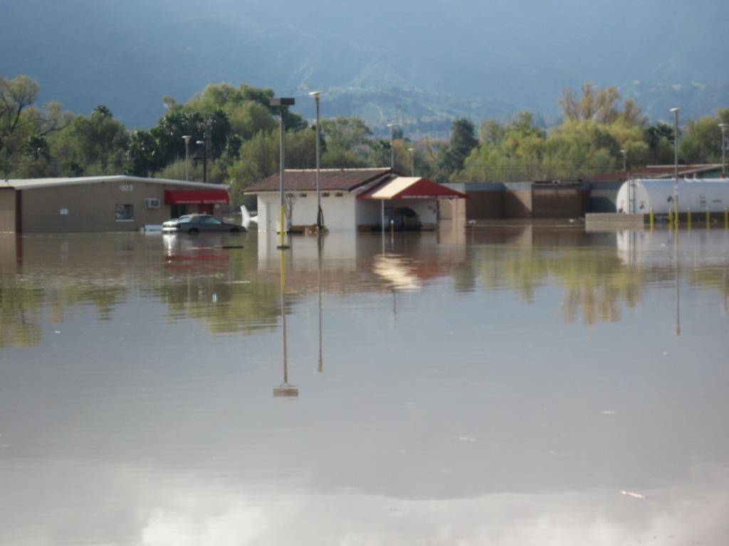
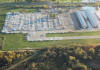
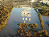
Airport Flood - December 2010 ! |
 |
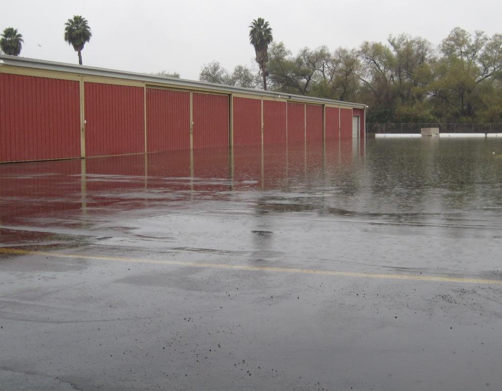
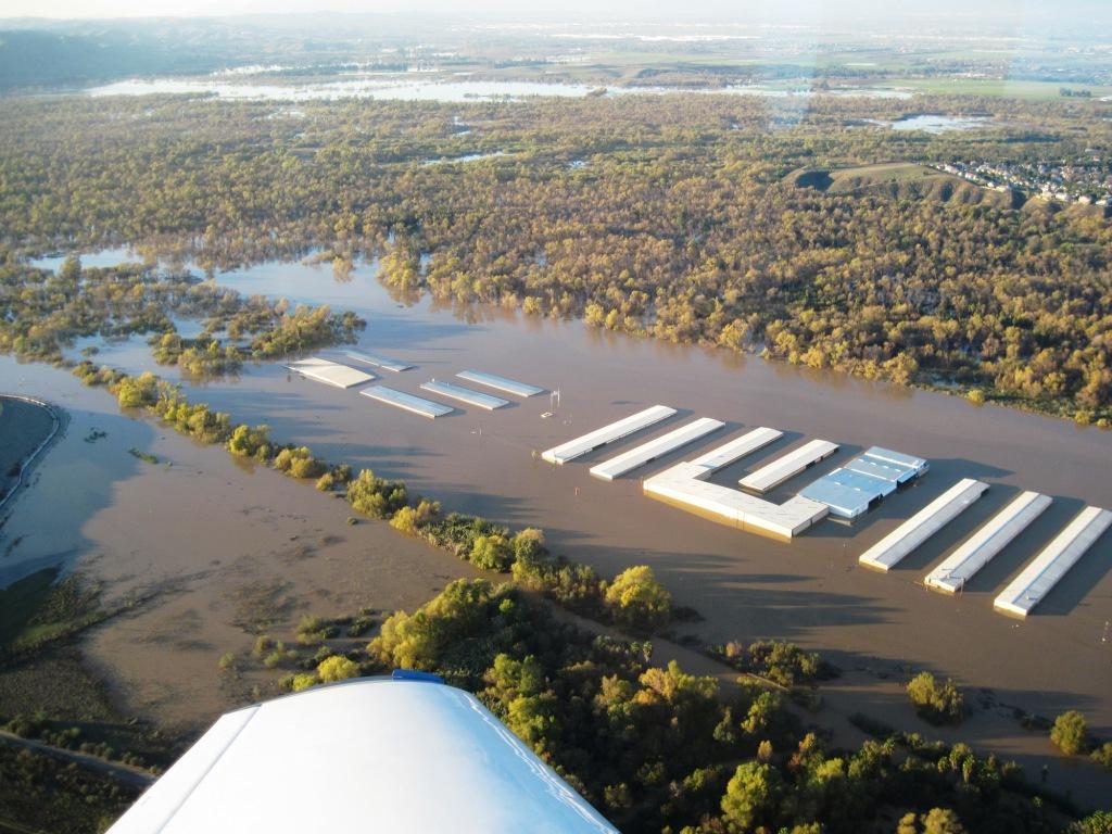
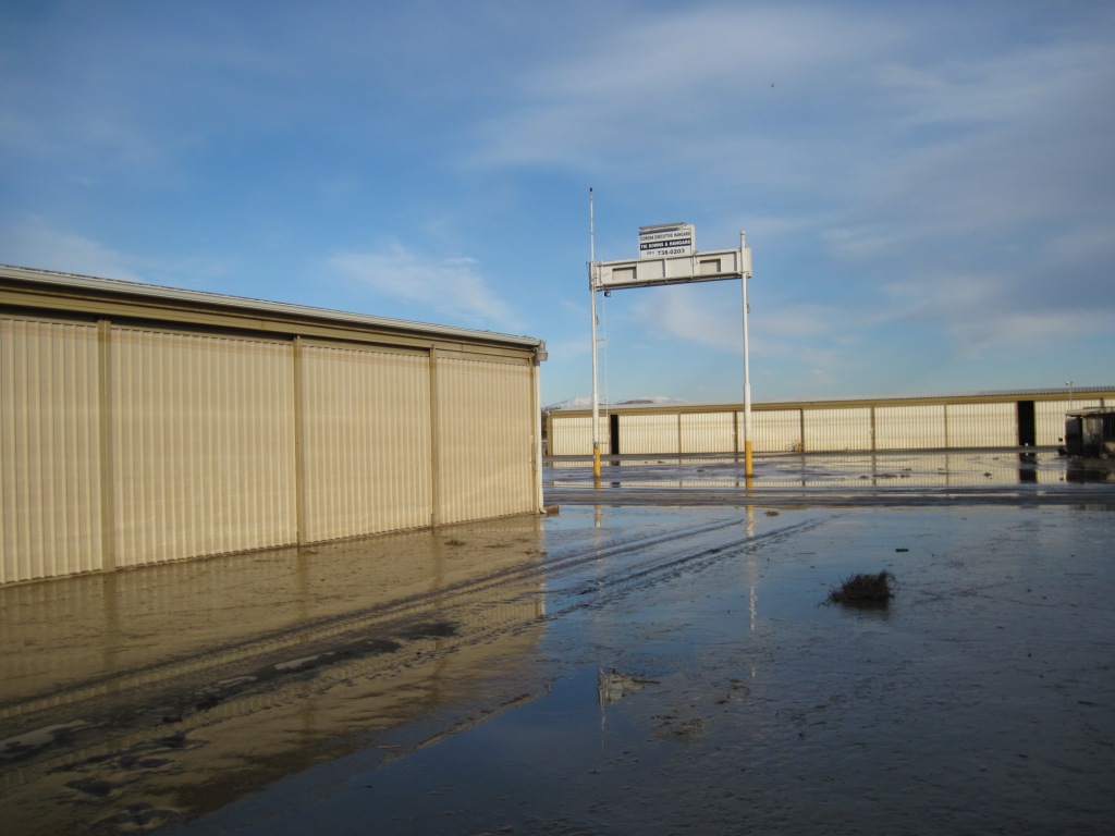
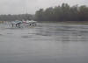
 Tuesday December 21 4:00pm, our 3rd day
of heavy rain. The flood waters are right at the end of the
runway.
Tuesday December 21 4:00pm, our 3rd day
of heavy rain. The flood waters are right at the end of the
runway.
|
|
The Underwater
Home of Bellanca N4201B |
|
First off, thanks to everyone who sent me an
email concerned for my safety, I and my plane are okay. We both survived the
Corona flood!
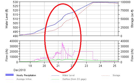
I had been been watching the
water level, inflow and outflow at Prado Dam for two days via the
web. I woke up at 4:00am (12/21) and the water had risen 6" an
hour for 6
hours to a level of real concern. I got dressed and was packing my
hangar before daylight. At first light the water was about 2 feet
below the west end of the runway and it was raining really hard. It
took three trips in my Chevy Tahoe, I got everything, even the trash
out.
By now the water was almost even with the west
end of the runway and it was still raining hard. When the runway
end goes under water the airport will be NOTAM'ed closed. Our AWOS was
reporting 100 broken and two miles. To my amazement Chino tower 7
miles away was VFR with 2700' and 3 miles. I called the local
controller on my handheld (no one was flying) and he verified they
were still VFR but they didn't expect it to last long. I jumped in
and taxied to the runway and did a quick runup half expecting the
airport manager to call on the radio saying the runway was closed. I
called Chino tower once more, they were still VFR so I departed.
Corona is in uncontrolled airspace so all I needed
was 1 mile and clear of clouds for VFR. Chino needs 3 miles and
1000'. It had been a wild morning and I was pretty hyped up at this
point, IFR was not something I wanted to do.
It would be better if I didn't talk about some
parts of that trip. You just need to know N4201B made it to a tie
down at Chino and all my hangar stuff (man cave) is in the garage.
Why were so many unaware the airport was about to
flood? There were several breakdowns.
~Few were notified. All the owners I spoke
with hadn't been notified of the rising water. Many heard about
flooding on the evening news. By then it was too late.
~There is not a good system to notify
aircraft owners of an event. Since 2006 I've asked the airport
manager to collect email and text page address so he could send a
warning to everyone in seconds be it fire or flood. It's never
happened!
~The day before the flood the city was telling
people the water would not exceed elevation 520' and most the
airport was okay. With that news many let their guard down. Within
36 hours we were at 530' and flood water had claimed 90% of the
airport. It was easy to see we were in real trouble and 520' would
be far exceeded. Do the math, the water was at 515' (end of runway)
with 35,000cfs inflow with only 4,500cfs outflow and 24 hours of
heavy rain in the weather forecast. My concern was the entire
airport could go under, the city insisted I was wrong. I fail to
understand why the city didn't see the danger.
~On both Tuesday and Wednesday city vehicles were
rushing up and down the runway with their yellow blinking lights,
they did nothing but give interviews to the press and get in the
way. Pilots took it upon them self to cut down the gate and street
signs and move aircraft to higher ground.
~The Army Corps of Engineers web site stopped
recording water elevations during the critical 36 hours leaving most
to think the water level wasn't increasing.
~Finally blame rests on Corona pilots and aircraft
owners who know the airport is in a flood plain but failed to check
in and see what was happening.
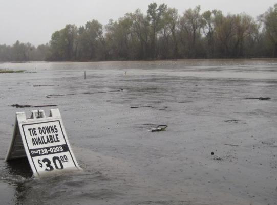
Anyone is welcome to use the
following pictures but you must give credit to
http://160knots.com
.
|
|
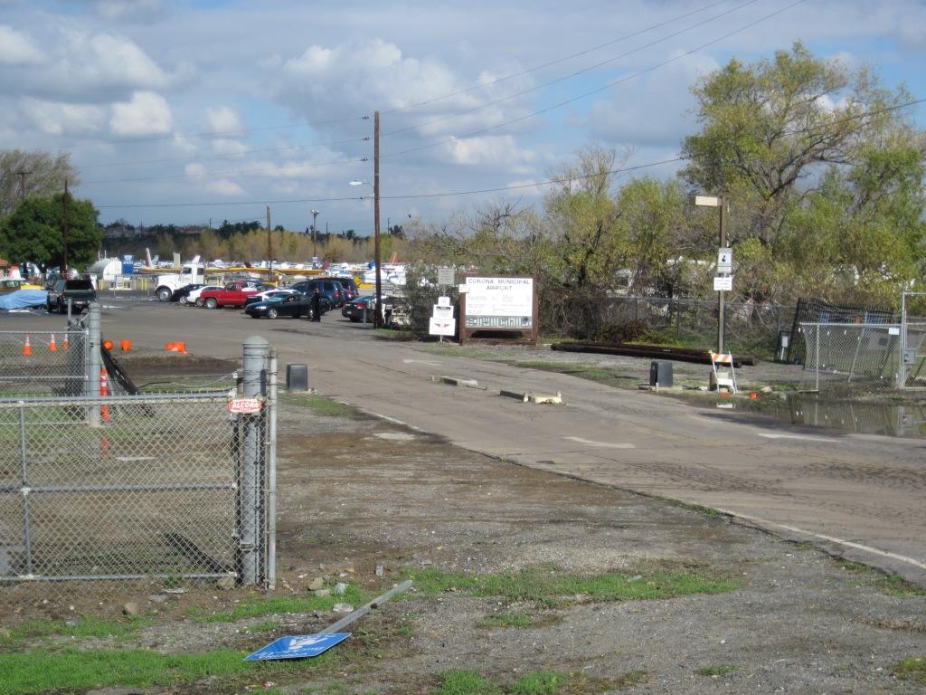
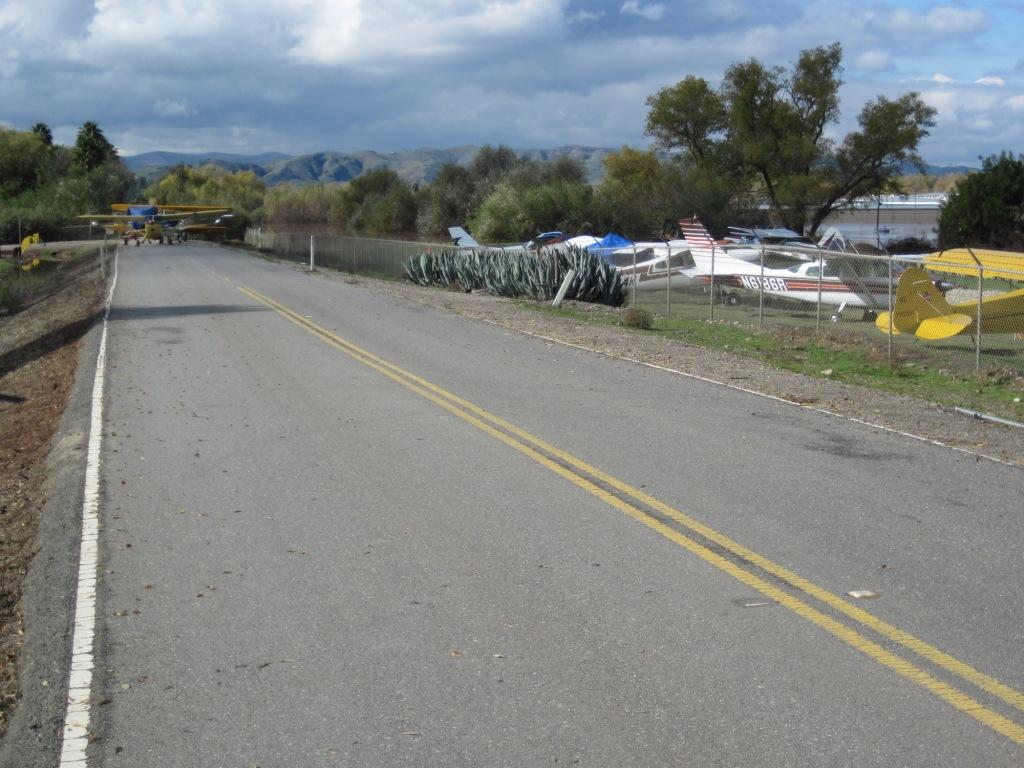
Pictures
taken on December 21, 2010! |
|
 |
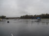
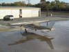
Taken from my hangar at 3:00 PM. The
water is starting to pond off the end of the runway. |
 |
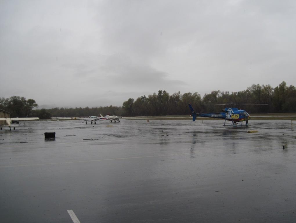
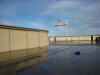
Air 7 HD drops in for a few minutes. |
 |
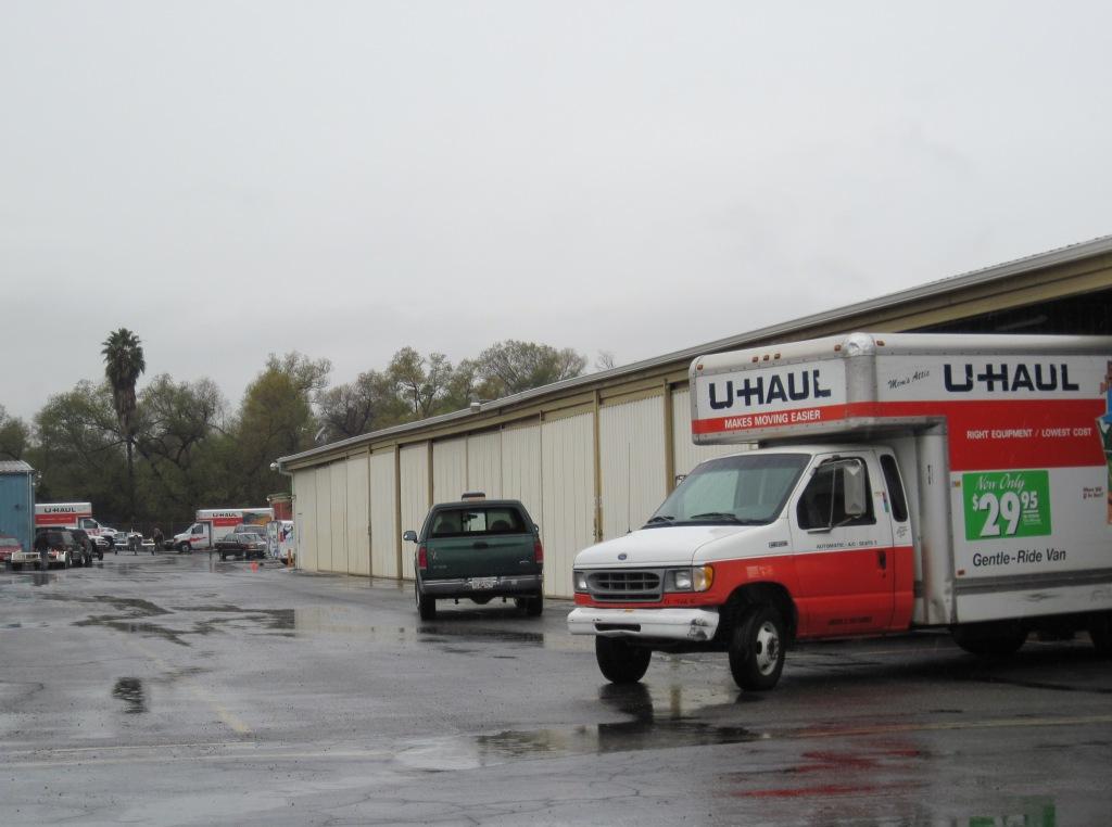
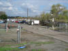
Found it amusing to see so many UHauls at
an airport. UHauls and an Airport, isn't that a bad thing? |
 |
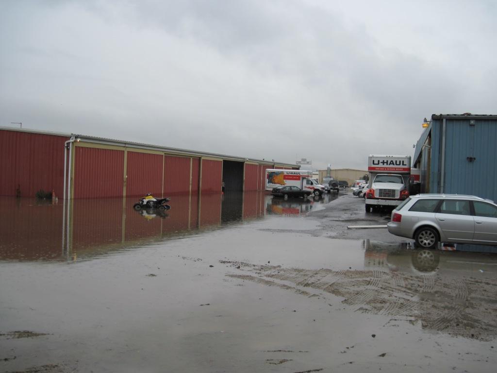
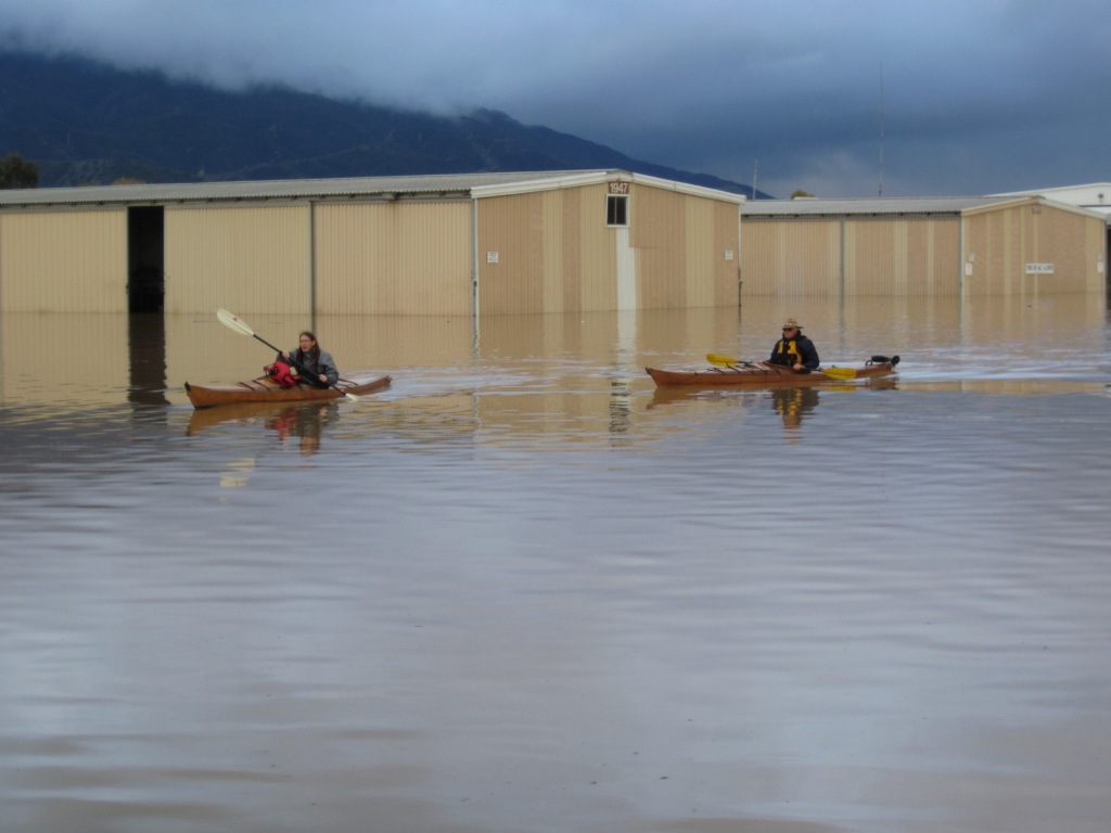
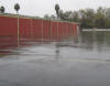
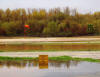
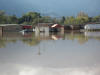
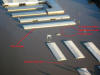
The lower areas of the airport are
already flooding as tenants scramble to save their
treasures. |
 |
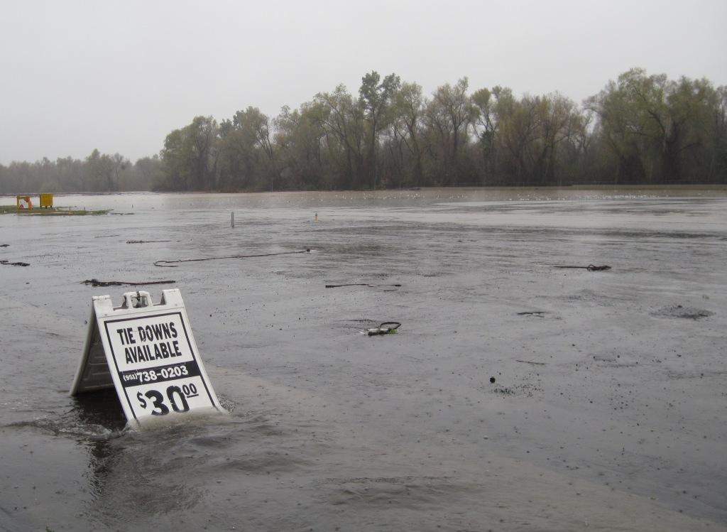
Water is slowing rising. |
 |
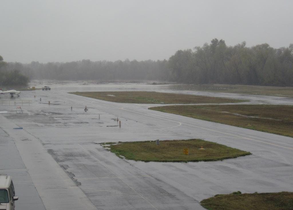
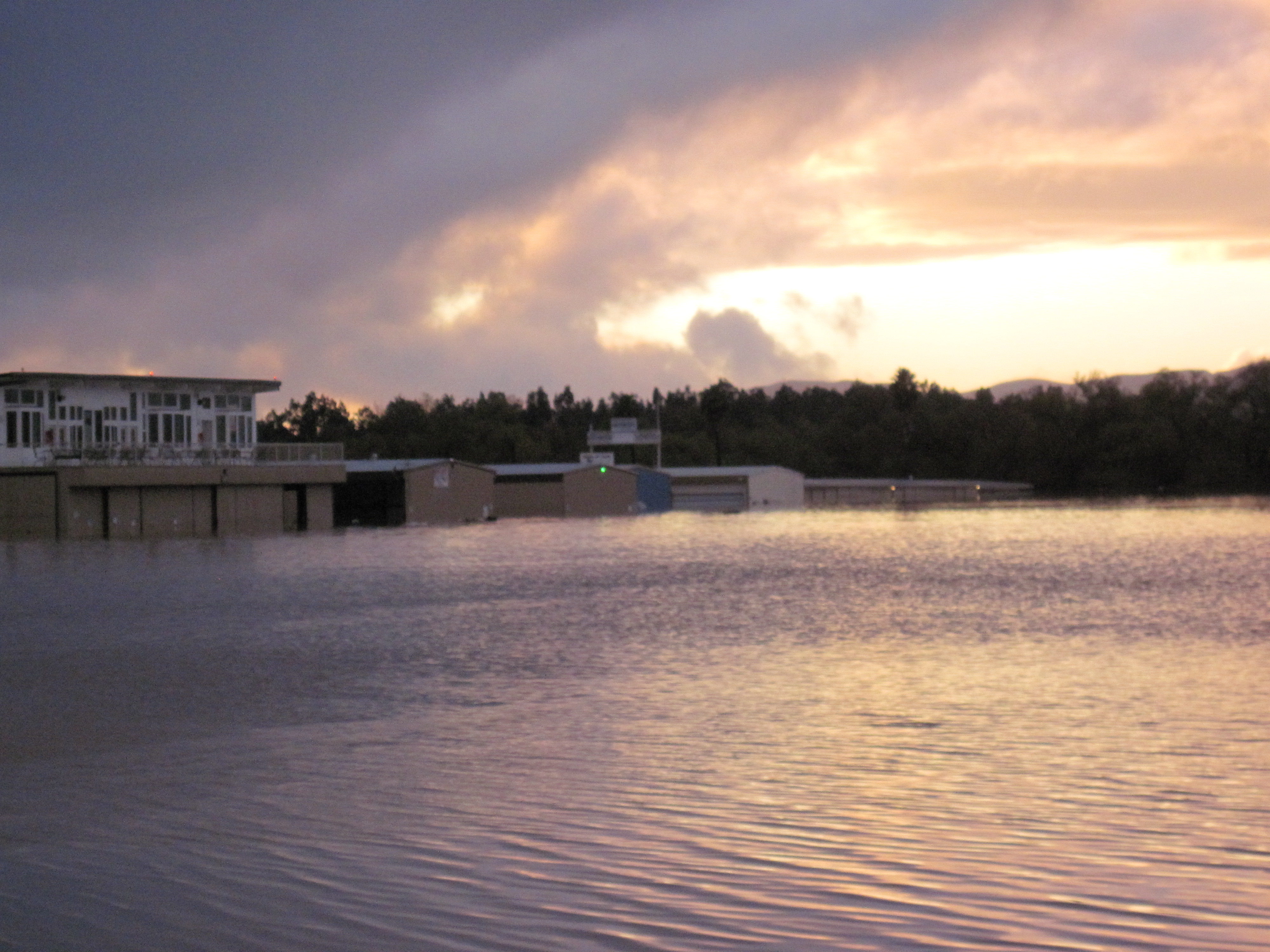
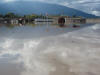
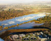
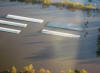
A 4:00pm view from the upper deck. I had
planed to take a picture here the next day at the same time
but I didn't have a boat. |
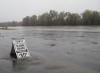 |
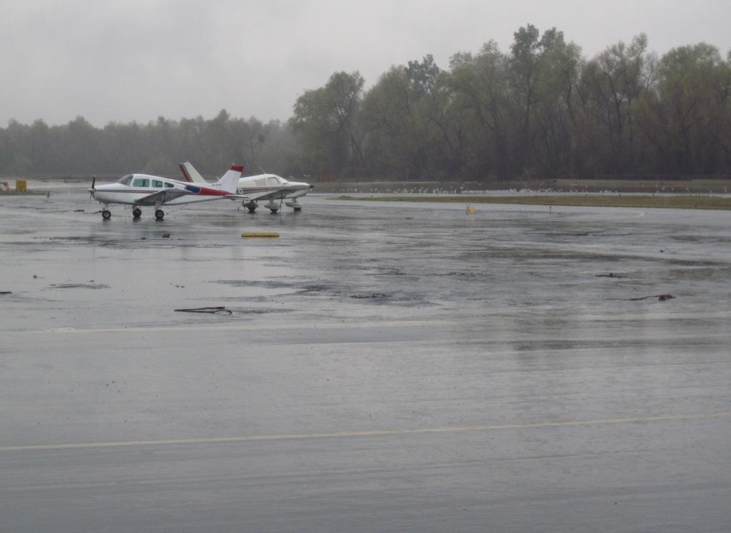
4:00pm and we are about to loose the
runway. |
|
|
Pictures
taken on December 22! |
|
 |
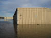
Water washed under the footing of the
retaining wall sending a wave across the airport. Most are
caught off guard. |
 |
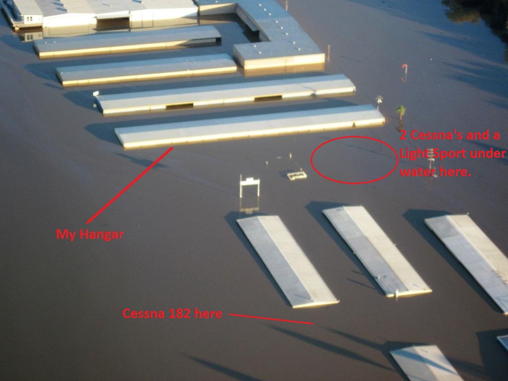
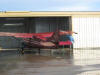
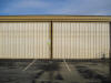
The last hangar end (yellow) is my row. |
 |
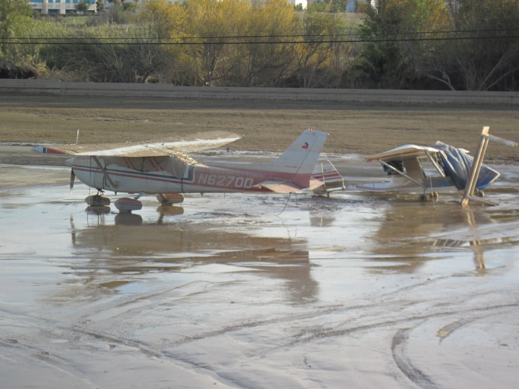
These guys were looking for a Cessna 182
they hoped someone else had moved. Unfortunately that
persons had to be rushed into emergency surgery. They found
the tail barely above the water line. |
 |
The fuel island is sand bagged just in
case. |
 |
The last hangar end (yellow) is my row. |
|
|
Pictures
taken on December 23! |
|
 |
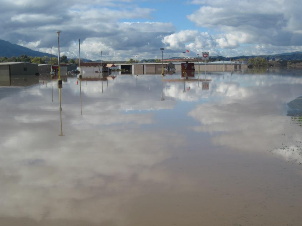
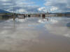
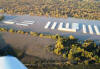
The water rises to the VASI and fuel
island. |
 |
Cheapest fuel in SoCal shuts down. |
 |
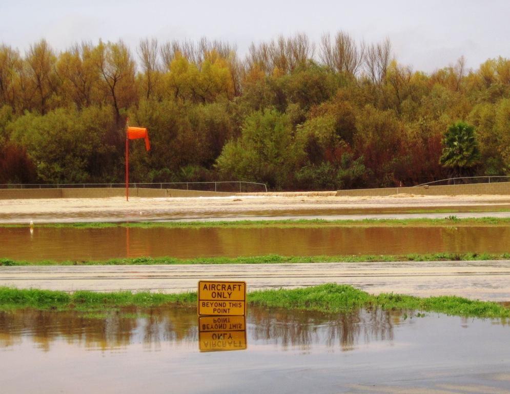
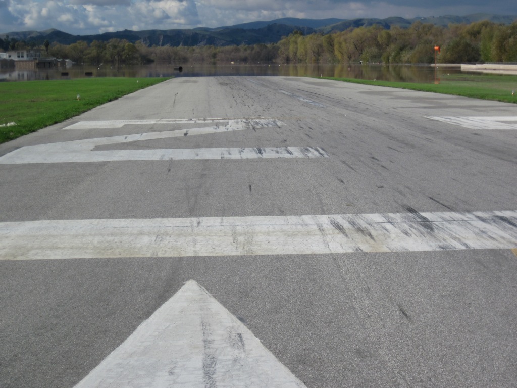
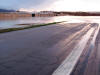
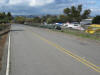
The approach end of runway 25 |
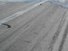 |
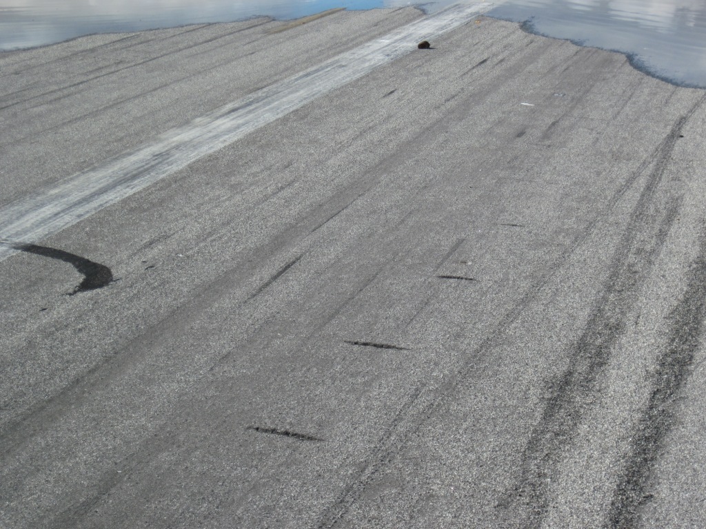
Strange marks on the runway? Two sets
about 18' apart. |
 |
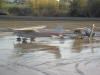
The guys on the bench didn't save the car
but the recliners made it to higher ground. |
 |
Over the objections of the airport
manager the gate, card reader and road signs are cut off so
aircraft can be moved off property. |
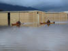
 |
Aircraft are moved to a road leading to
the park. |
|
|
Pictures
taken on December 24! |
|
 |
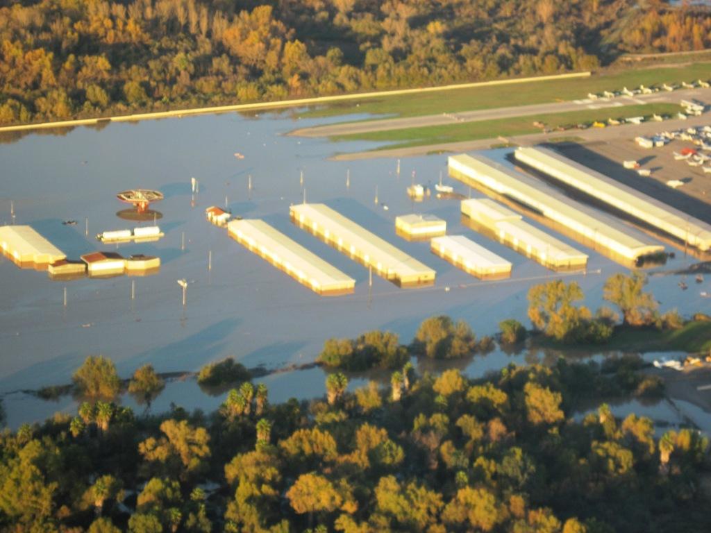
Wow!!! Looks a lot different from the
air. |
 |
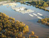
The fuel island again. The water has
receded almost a foot. |
 |
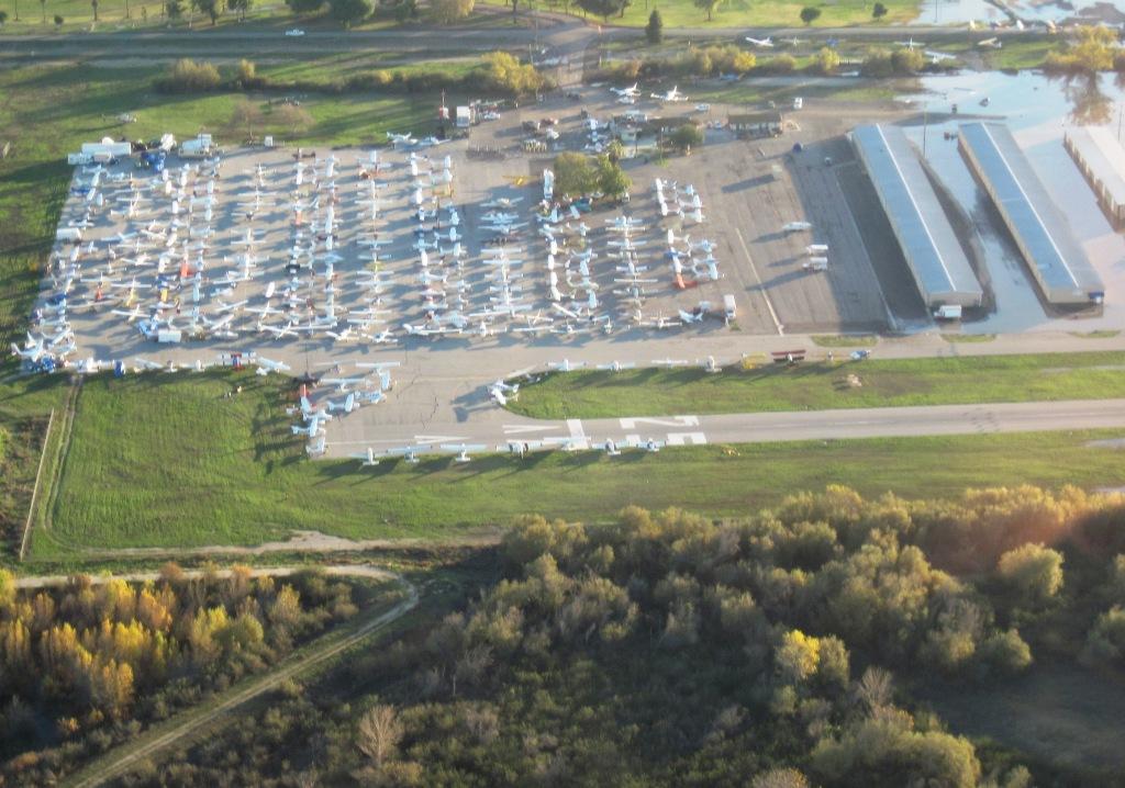
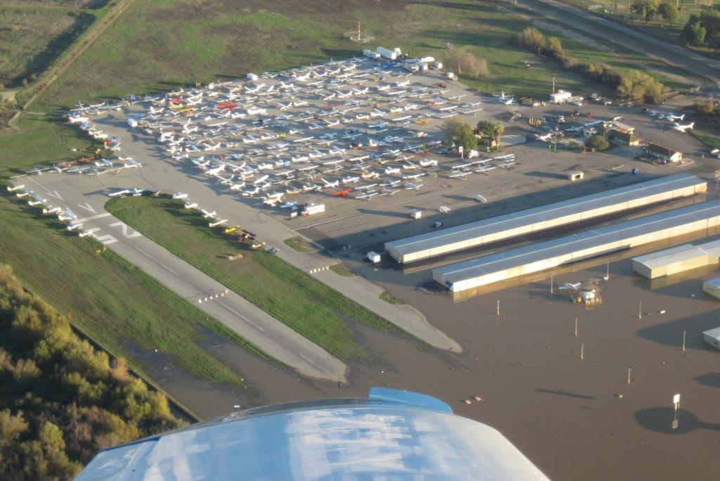
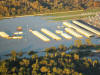
Aircraft are packed into higher ground.
If the water goes up a few feet more all may be lost. |
 |
|
 |
The sewage treatment plant was diked off
a couple of years ago but not the airport? The airport was
there several decades before the sewer plant. |
 |
Midfield |
 |
|
 |
Looking down runway 07 |
 |
The deep end. This is where the UHauls
were loading up 4 days ago. |
 |
My hangar and some submerged aircraft are
located here. |
|
|
Pictures
taken on January 5, 2011! |
|
 |
As the water receded aircraft hidden
from view re-appeared. |
 |
These aircraft had spent almost 2 weeks
underwater. |
 |
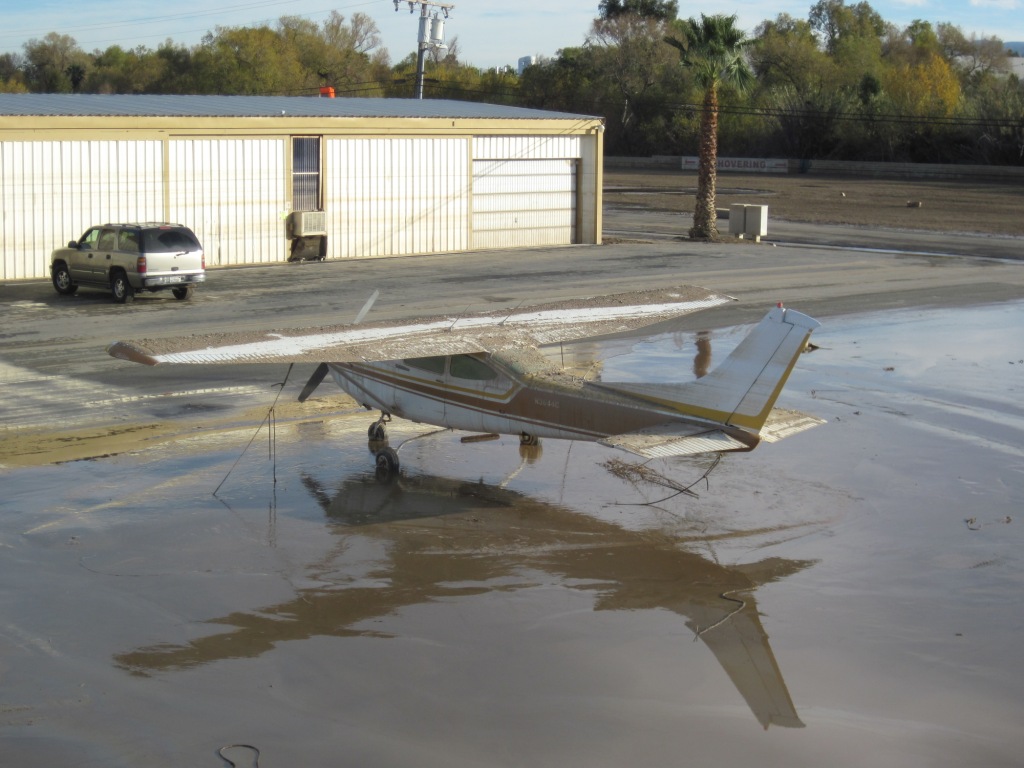
My hangar neighbor 3 doors down trying to
reclaim his plane. |
 |
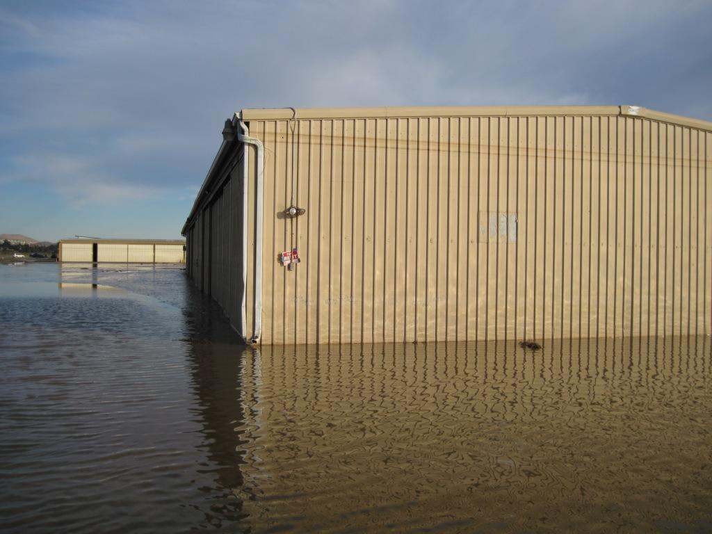
Note the high waterline. |
 |
The waterline here was almost to the
roof. |
 |
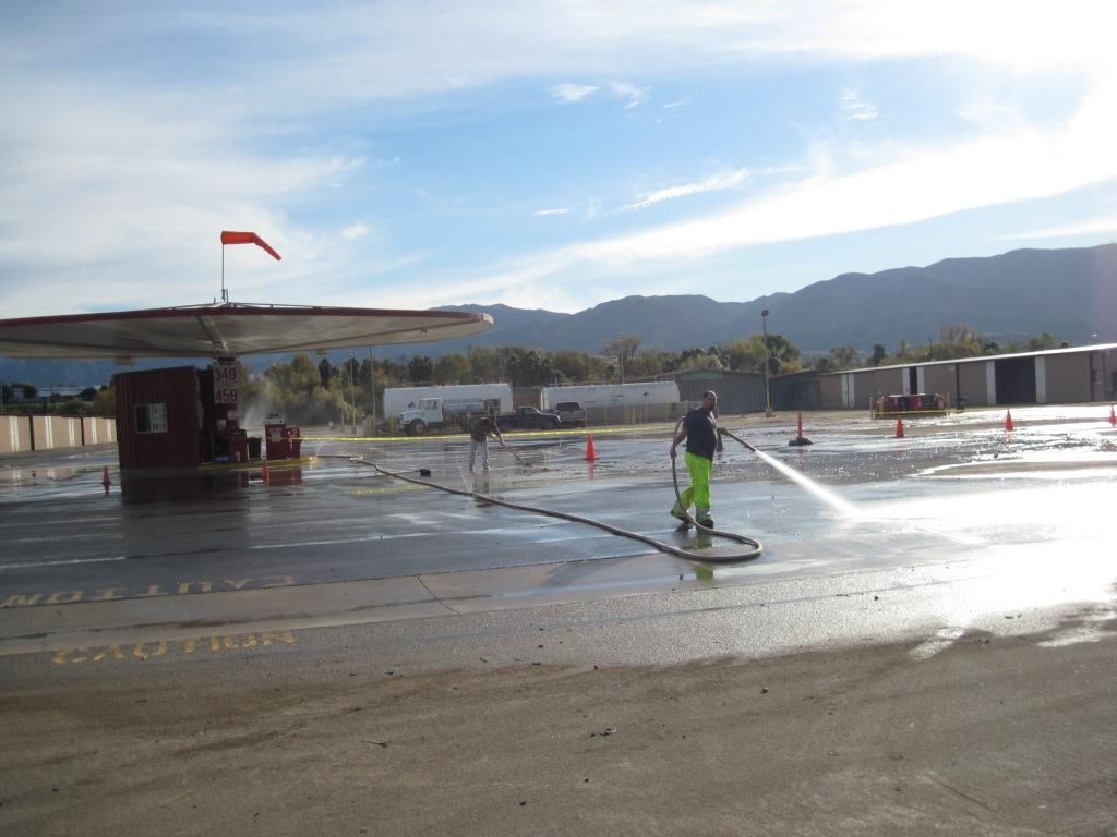
The fuel island gets washed down |
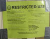 |
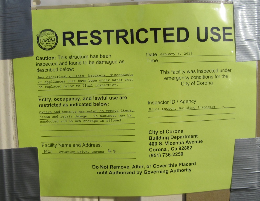
Hangars were yellow or red tagged by the
city of Corona. |
 |
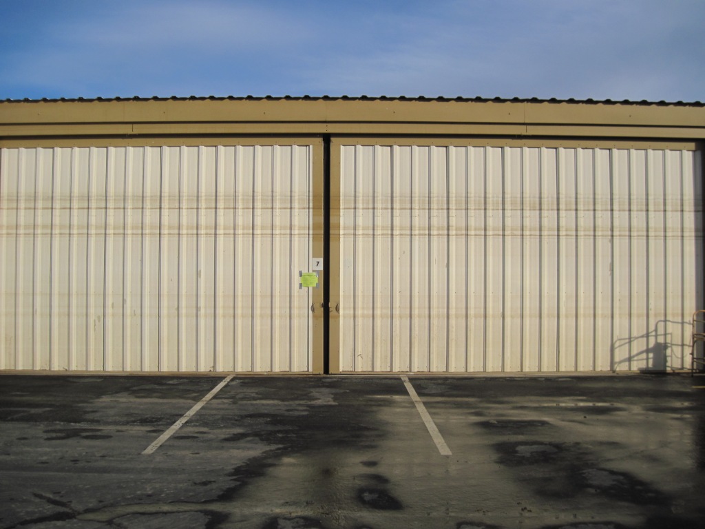
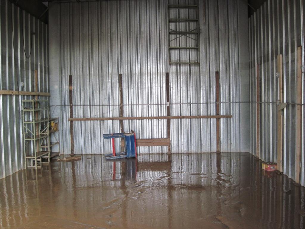
This is my hangar. The water line is
clearly visible. I can't understand why the taxi way was
washed down when just inside the doors... |
 |
...there is 3" of mud. |
|